MnDOT - Highway 67 Granite Falls to Echo Project
Welcome
Public engagement on transportation and construction projects is a MnDOT priority and we appreciate you joining us online to learn more about the Hwy 67 projects.
Continue clicking through to learn more about the project.
Click the image above to enlarge.
Sign Up for Project Updates
For more information and to sign up to receive project updates, please visit: www.dot.state.mn.us/d8/projects/hwy67granitefallstoecho
How to Navigate
- Click the arrows on the right of your screen to go forward or the left to go backward.
- Use the navigation bar on the top of your screen to revisit any part of the meeting.
How to Participate
- Click through the slides to learn more about the Hwy 67 Granite Falls to Echo project.
Overview
Project history and overview
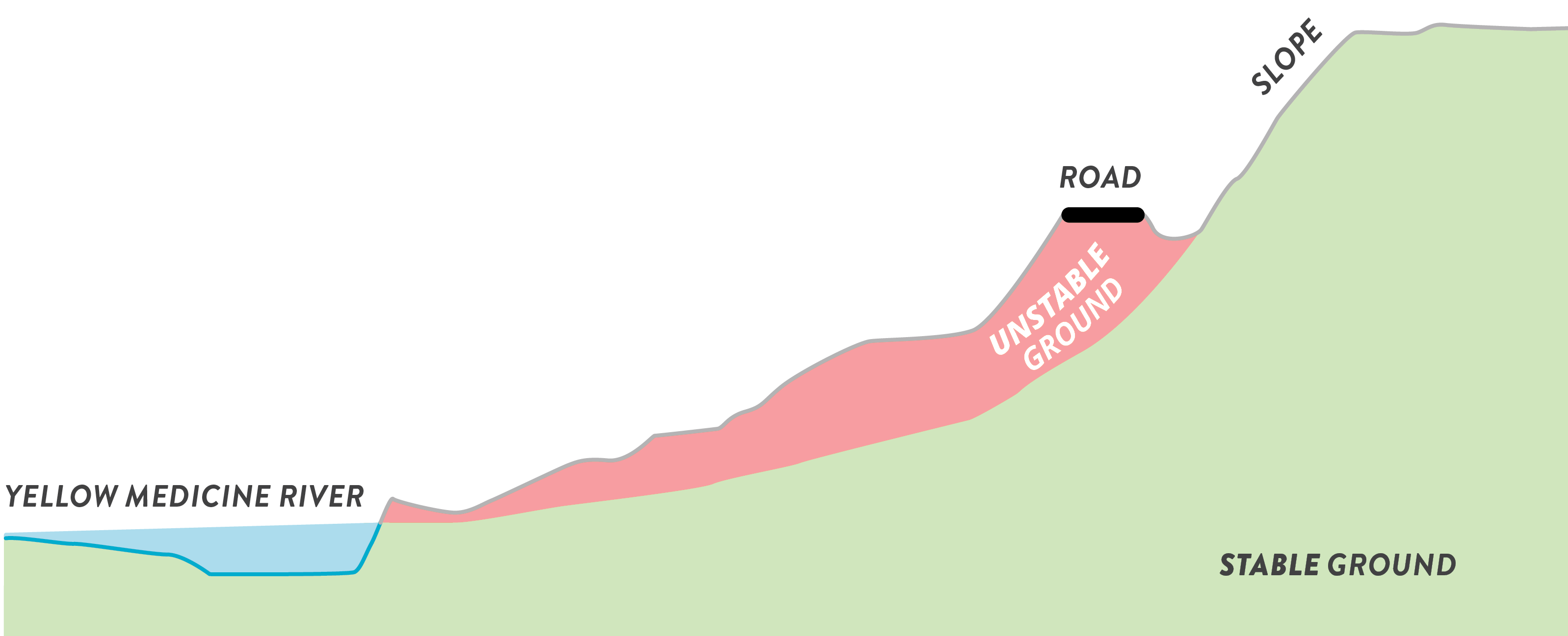
- In spring 2019, MnDOT closed a portion of Highway 67 between Granite Falls and Echo.
- The roadway carries about 400 cars per day and is built along a slope near a bend in the Yellow Medicine River.
- It is unstable due to movement of the earth underneath the roadway.
Click the image above to enlarge.
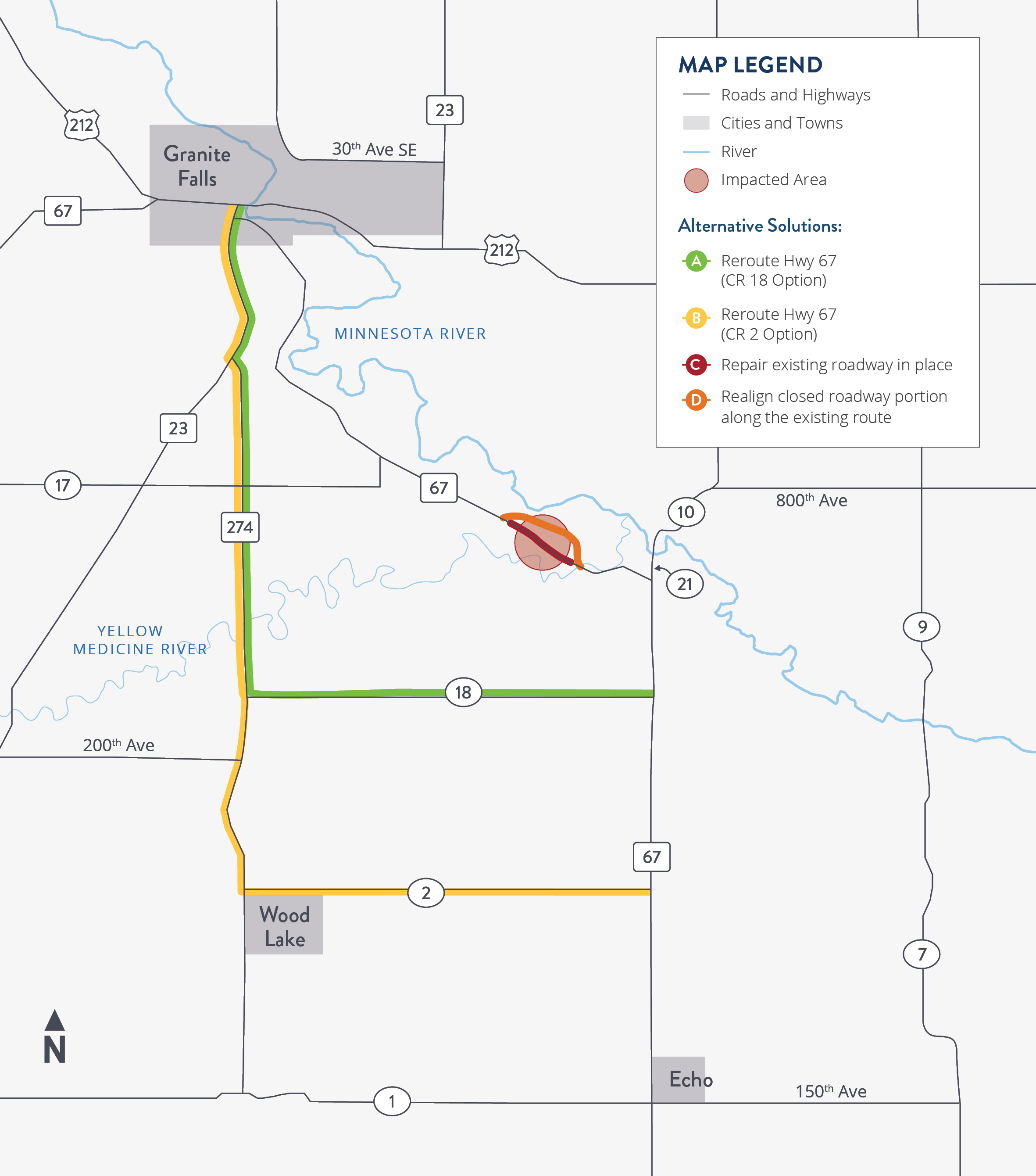
Project Area Map
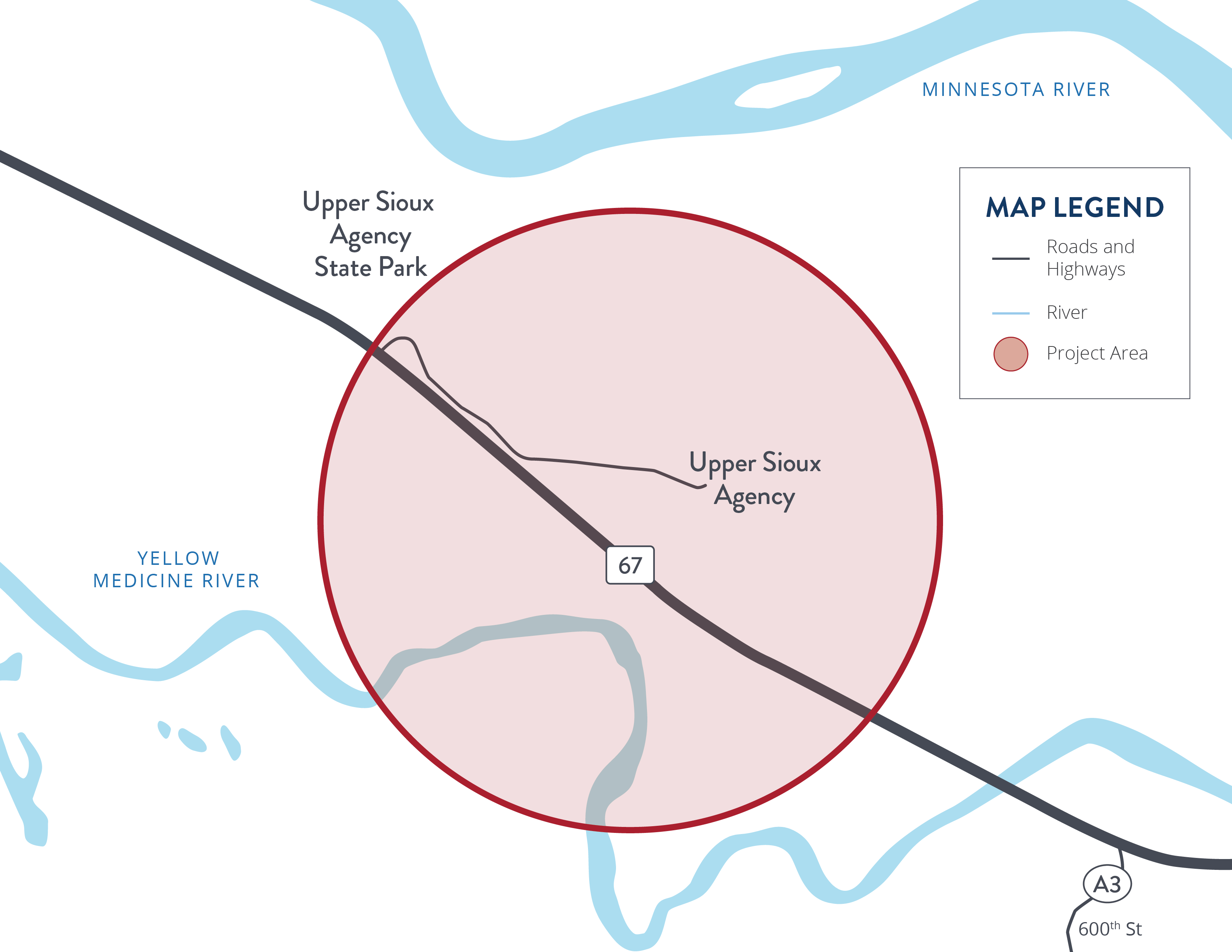
Click the map to enlarge.
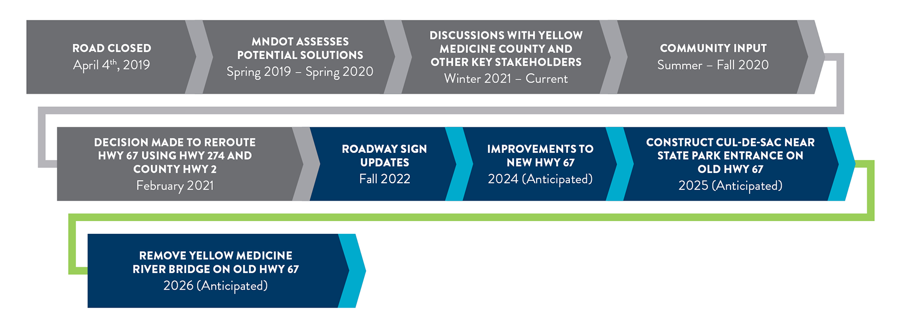
Project Schedule
From road closure onward
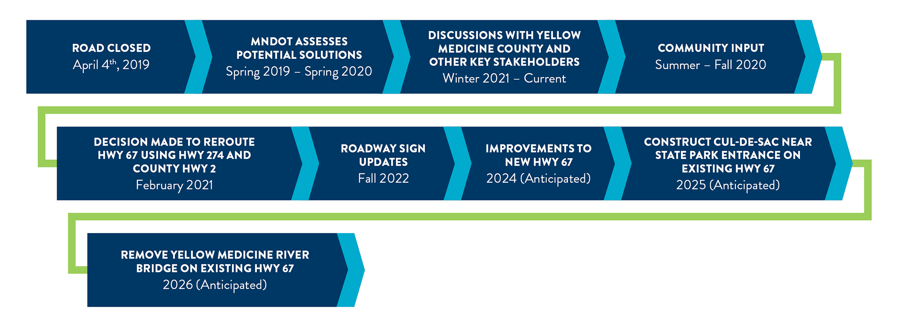
Click the image above to enlarge.
Project History
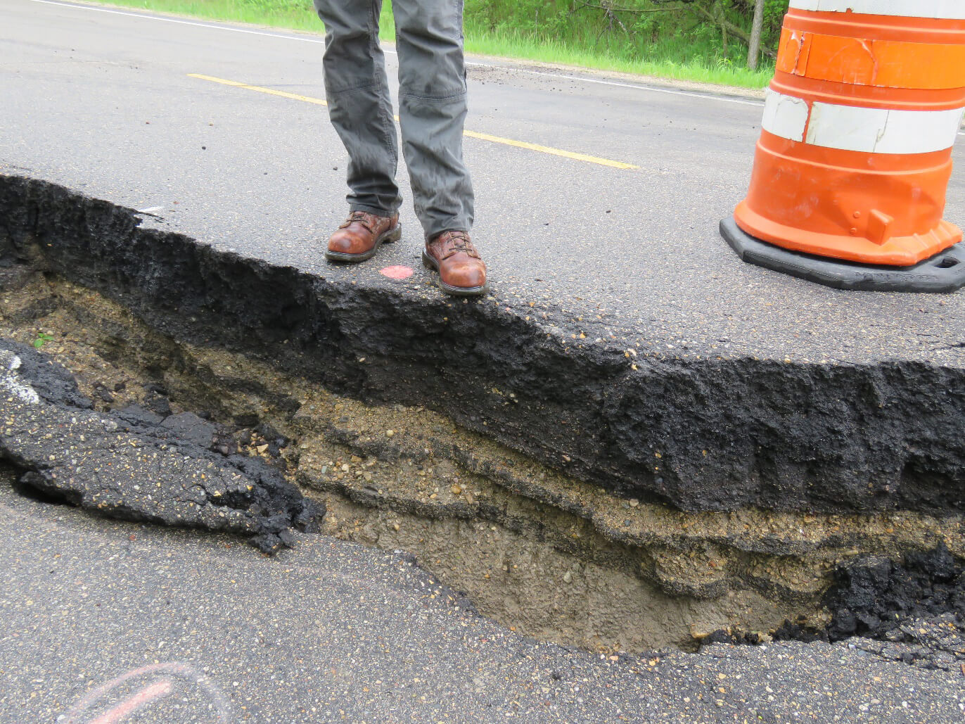
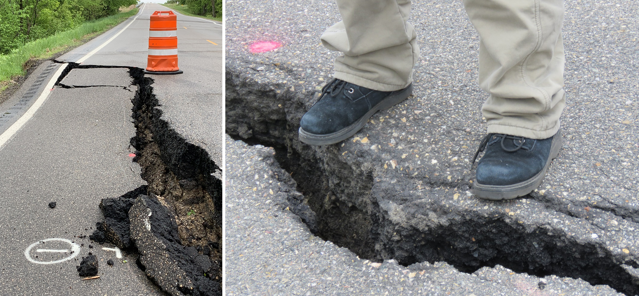
Pavement Cracking
In April 2019, MnDOT observed cracking in the pavement along Highway 67. MnDOT closed the roadway and continued to monitor the cracking, which continued to worsen. Monitoring movement in the hillside was MnDOT's first step in determining the options for Highway 67.
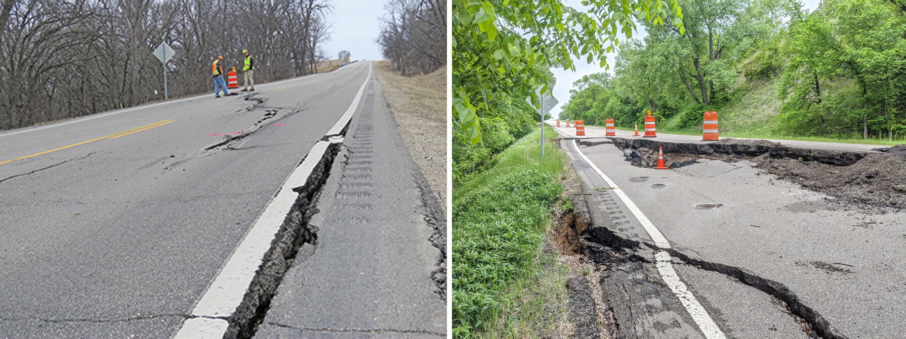
Click the image above to enlarge.
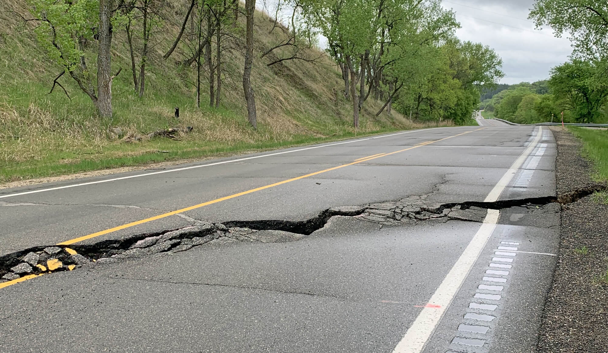
Ground Movement
In addition to the cracking in the pavement, MnDOT also observed significant ground movement along the Yellow Medicine River, located downhill from the roadway. The cracks in the ground captured at the river level show the scale of movement.
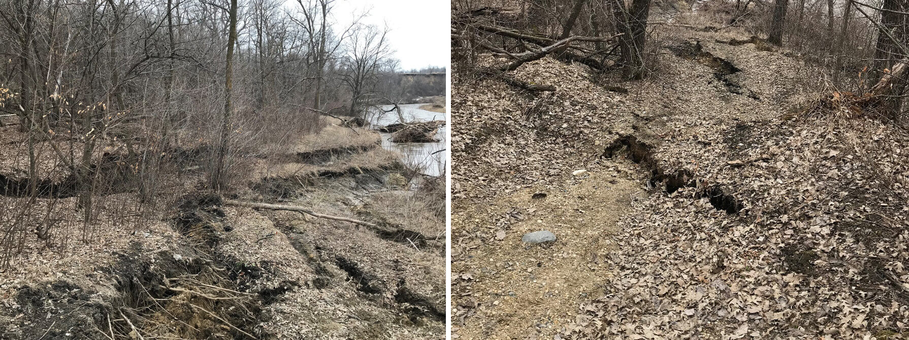
Click the image above to enlarge.
Topographic Conditions
As a next step, MnDOT further analyzed the ground conditions near the closed portion of roadway. The analysis showed that the ground in this area has a history of movement due to its location near the river bend, drainage characteristics and soil types. The images show a topographic view of the area. Note the bowl shape along the bend of the river in the images below. The ground is unstable 50 to 85 feet below the road at various locations.
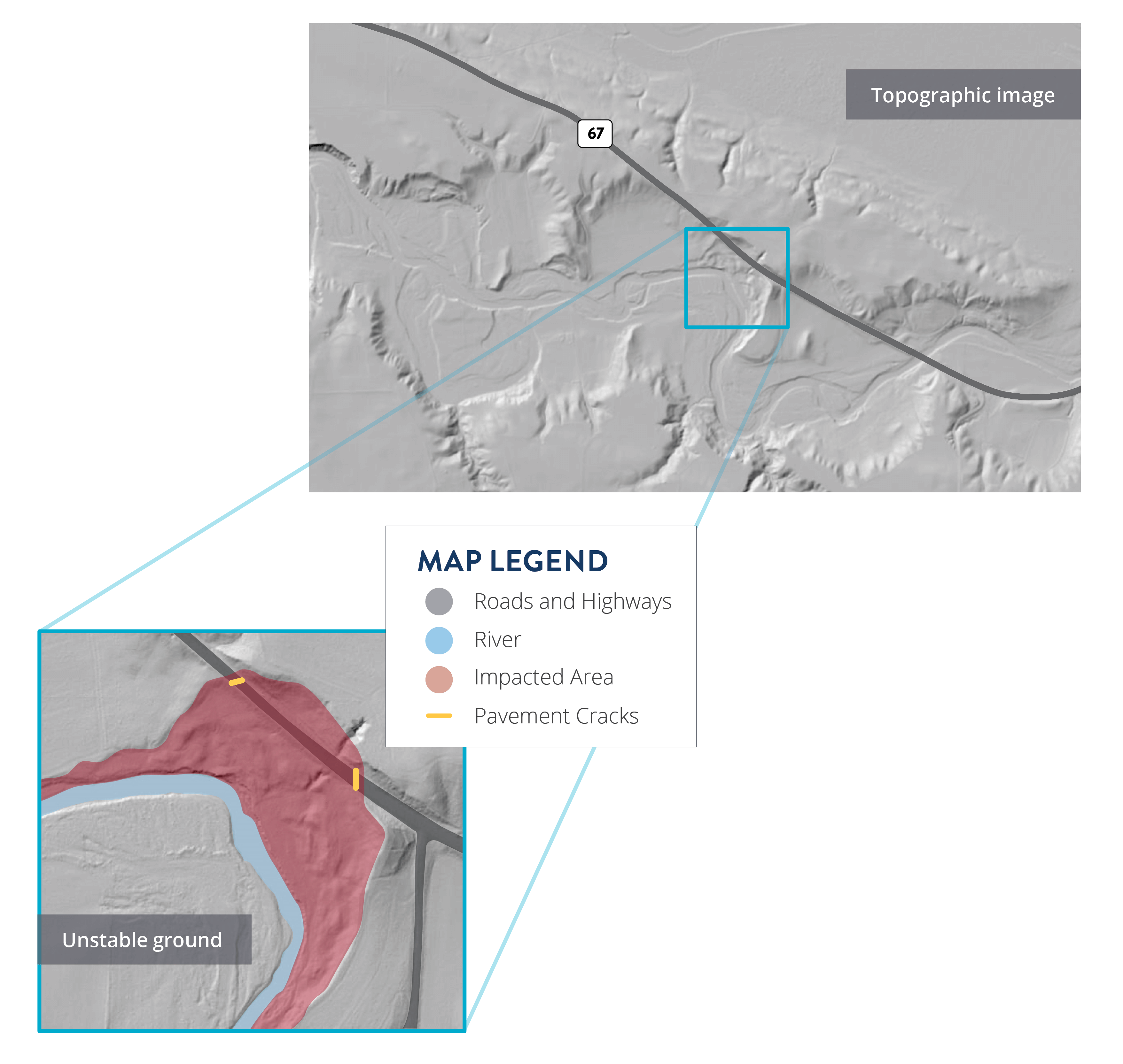
Click the images above to enlarge.
Repair and Realignment Alternatives
Explored options
MnDOT worked with partners throughout 2019 to identify several potential solutions to re-open the closed portion of Highway 67. The solutions considered included repairing the roadway in place, realigning the roadway along the existing route or rerouting Highway 67 via other roadways. We determined that that repairing or realigning the roadway are not feasible options due to:
High cost of the project. The ground is unstable 50 to 85 feet below the road at various locations. Repairing the roadway in place would cost roughly $30 million.
Significant impacts. The impacts to the environment and the historic and cultural sites are high because of the level of construction required to stabilize the ground.
Repair and Realignment Map
Click the diagram to enlarge.
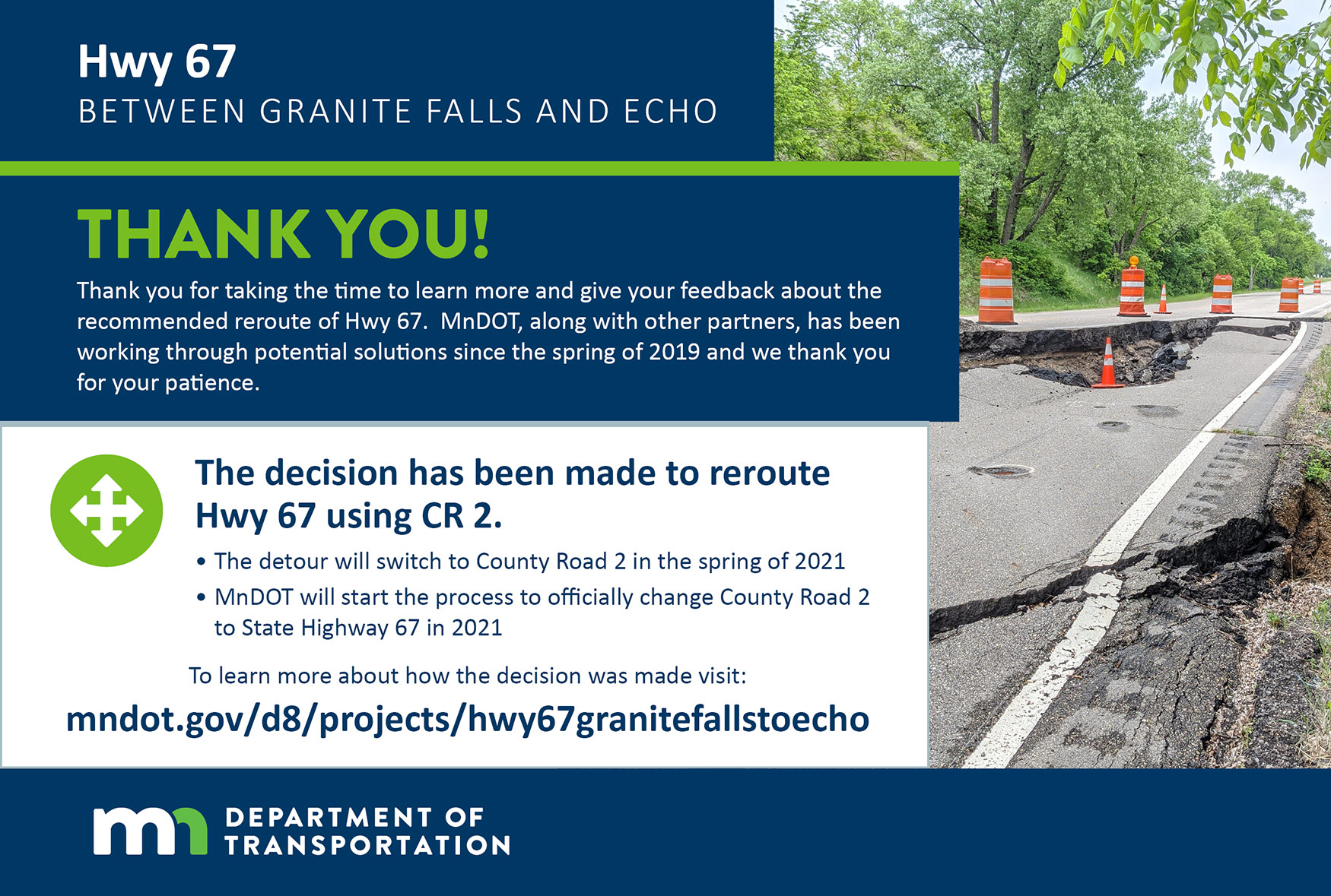
Reroute Decision
Reroute Via Hwy 274 and County Road 2
Highway 67 will be rerouted using Highway 274 and County Road 2. This decision comes after working with partners and the community, gathering input through a virtual open house, assessing impacts of route changes for local residents, and considering overall cost and impacts of each option.
New Hwy 67 Route

Click the image above to enlarge.
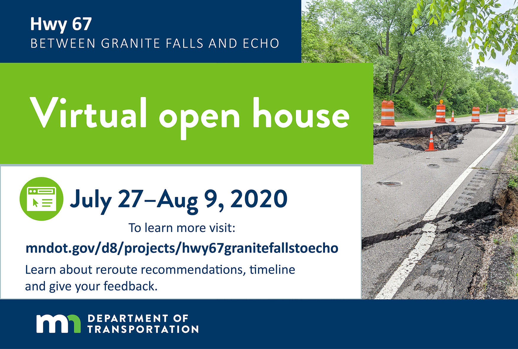
What We Heard
In the summer of 2020, MnDOT asked for input on two options to reroute Highway 67. The public did not indicate a clear preference on reroute options. Therefore, based on technical analysis and input from key stakeholders, the decision was made to reroute using Hwy 274 and County Road 2.
Tools and Activities
MnDOT used the following engagement tools and activities to spread awareness and gather community input:
- Project website
- Project area maps
- Project overview handout, updated with new information at key project milestones
- Project overview video
- Letters to impacted landowners at three key milestones
- Virtual public meeting with online survey
- Promotions for virtual public meeting including social media, newspaper and postcards
- Promotions to inform the community about the final recommendation including social media, newspaper and postcards
Stakeholder Discussions
Specific project discussions were held with the following stakeholders throughout the decision process:
- Upper Sioux Community
- Minnesota DNR
- Yellow Medicine County
- Renville County
- City of Echo
- City of Granite Falls
- City of Wood Lake
- Local Officials
- Local Emergency Responders
- Upper Minnesota Valley Regional Development Commission
- Impacted Landowners
Click the image above to enlarge.
Click the image above to enlarge.
What Comes Next
Looking ahead
MnDOT will officially change County Road 2 to State Highway 67 starting in the Fall of 2022. Roadway signage will be updated to reflect this change on the following highways:
- Hwy 23
- Hwy 274
- Hwy 67
- County Hwy 2
- County Hwy 21
- County Hwy 6
For the first 2 years, these highways will have both the old and new signs next to each other to ease the transition for local drivers. Please view the map on the right for full details on future highway designations.
Upcoming Construction Projects
The following improvements will be made to local roadways:
- 2024 (anticipated): Improvements will be made to existing County Hwy 2 / future Hwy 67 including striping, rumble strips and bridge guardrail installation at a county ditch.
- 2025 (anticipated): A cul-de-sac will be constructed on existing Hwy 67 / future Hwy 167 near the state park entrance.
- 2026 (anticipated): The Yellow Medicine River Bridge on existing Hwy 67 / future Hwy 167 will be removed.
New Roadway Designations

Click the image above to enlarge.
Project Schedule
Click the image above to enlarge.
Stay Connected
Thank you for your interest in Highway 67 Granite Falls to Echo projects
Sign Up
To sign up to receive text message or email project updates, please visit: www.dot.state.mn.us/d8/projects/hwy67granitefallstoecho
Connect
Join the Facebook group:
MnDOT | Southwest Minnesota
Share
Please pass along the link to your family, friends and coworkers that use Highway 67 in this area so they are informed and can sign up for email updates.
Contact the Project Team
Cody Brand, Traffic Engineer
cody.brand@state.mn.us | (320) 979-4720
Tyler Bauchmen, Project Manager
tyler.bauchmen@state.mn.us | (320) 231-5195